
The purpose of this project was to federate a large amount of disparate survey data captured across 35 miles of railway track from London Paddington to Reading. The two main aims of the project were:
1. Federate all data in one web-based platform to allow users to have easy access to video surveys, LiDAR scans and aerial imagery.
2. Use artificial intelligence (AI) and machine learning (ML) to automatically recognise and extract assets from the various datasets, geo-locating them on the GIS interface and making the data accessible via API.
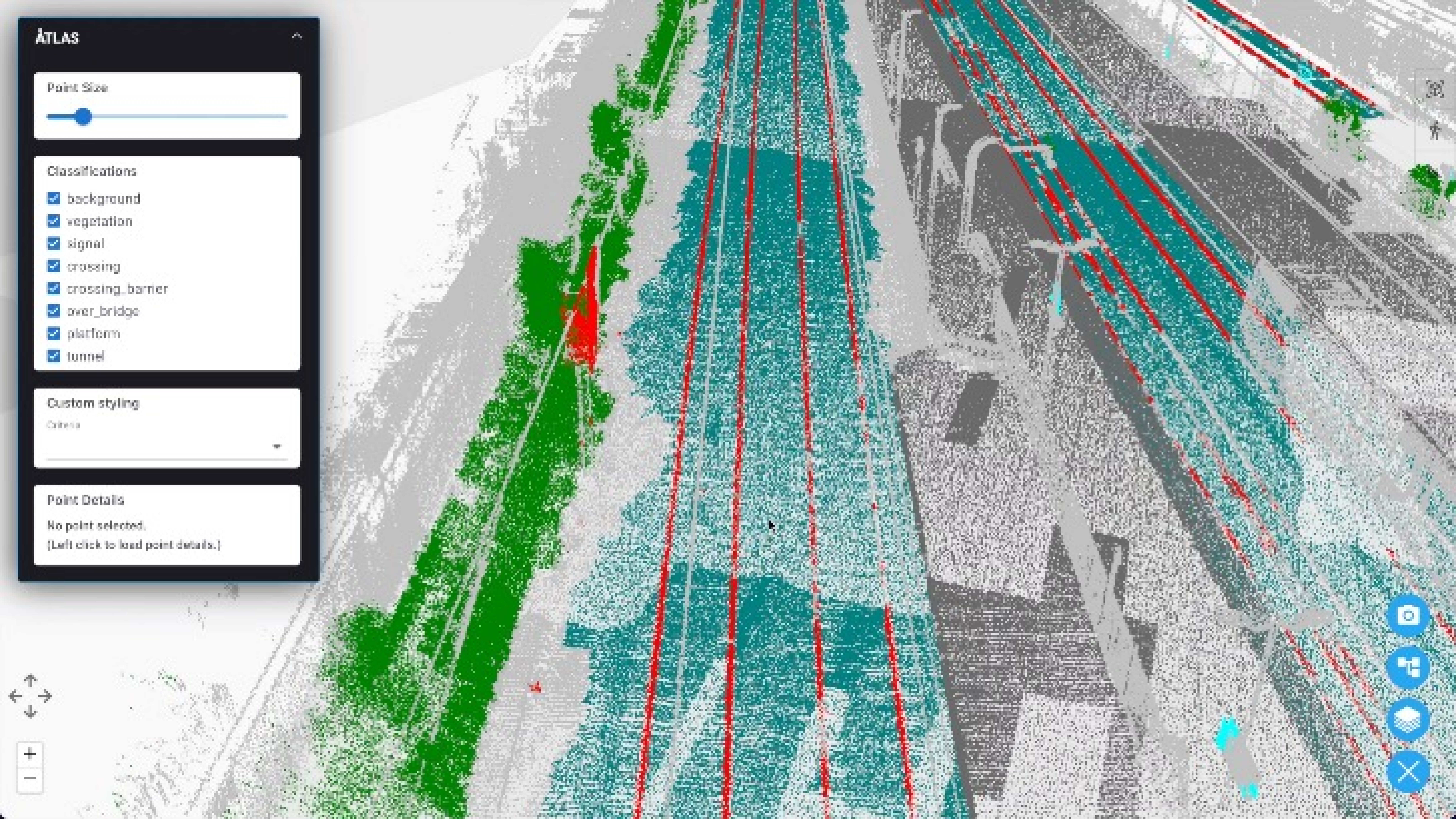
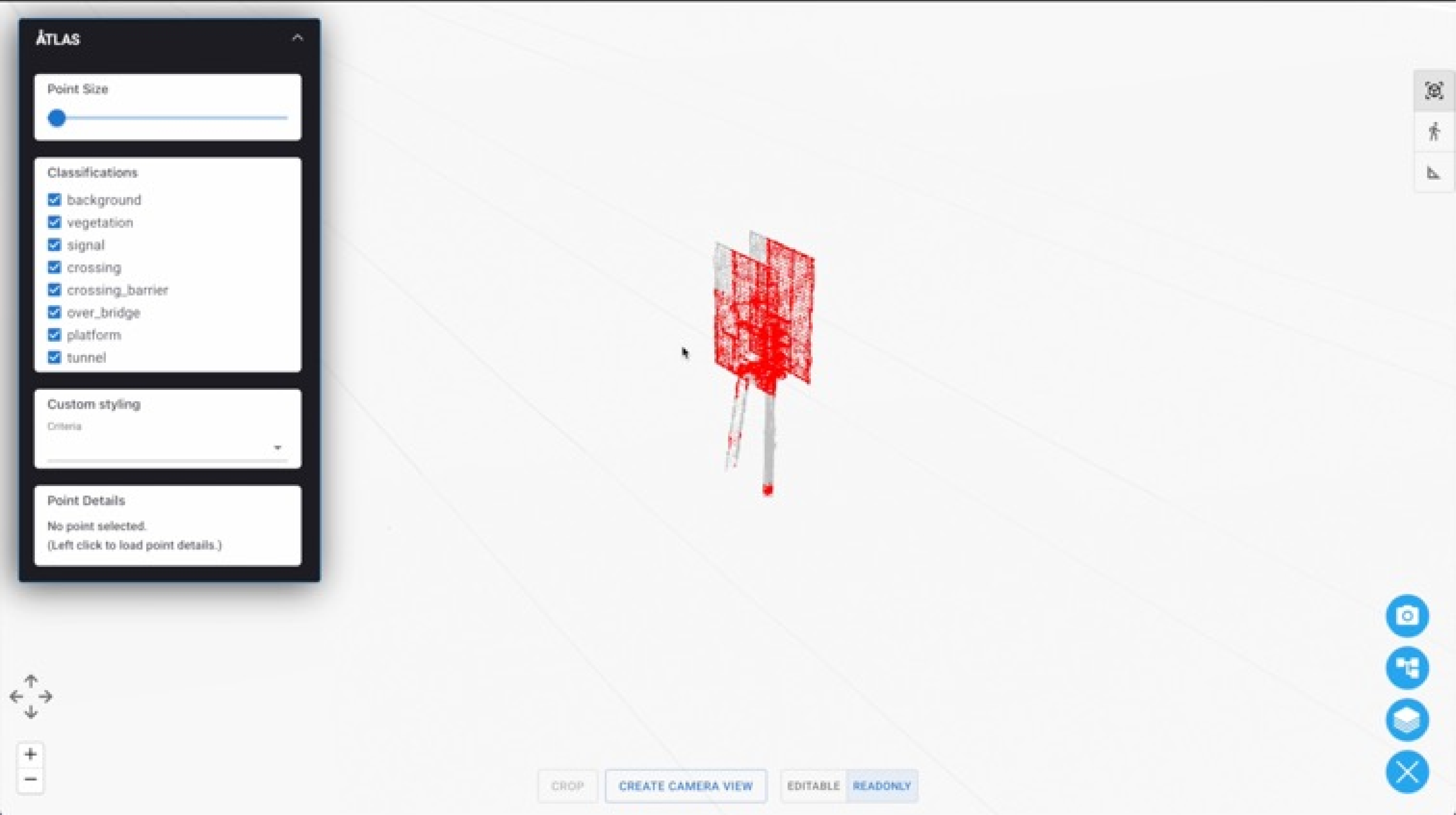
ATLAS utilises state of the art artificial intelligence (AI) to automatically recognise, segment and cluster assets along the railway from point cloud scans. Our AI models have been trained on numerous asset classes including signals, platforms, rails, bridges, vegetation and more.
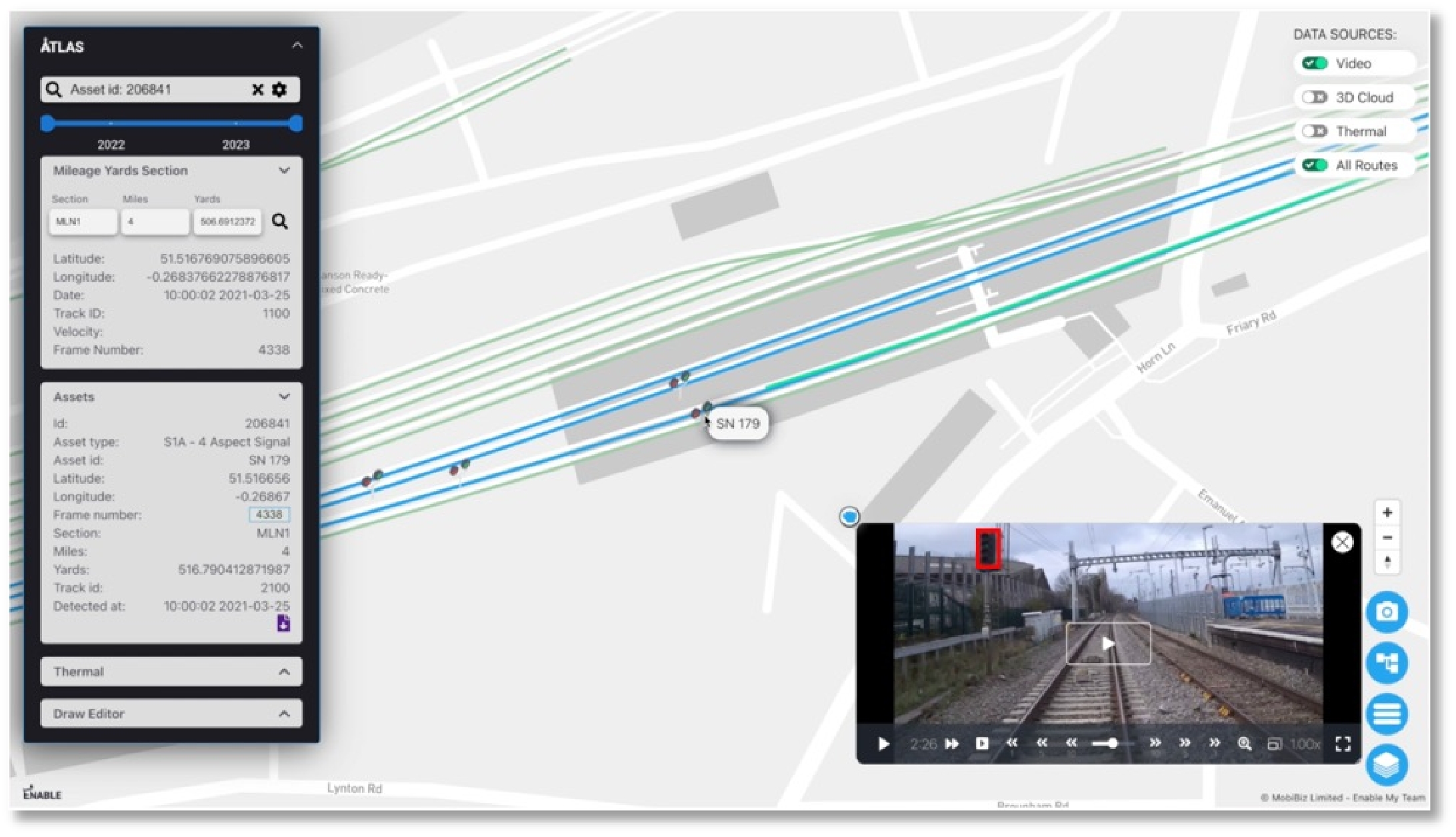
Our AI models were run on both Forward Facing Video (FFV) and Point Clouds for the Wales & Western project. We used optical character recognition to automatically extract text content such as signal ID plates. Our AI tools can also be used to convert these videos and images into 3D scenes.
By federating the data sets together, we were able to take the optimal information from each set and build a full picture. For example, for a detected signal, we used the location data from the LiDAR, combined with the Signal ID extracted from the video.
Once we have an ID we can create relationships to existing references of this specific signal, in any third party system, maintenance database or schematic. ATLAS is built upon an asset information management system, which allows us to create this golden thread connecting the same asset between all data sources, removing silos.
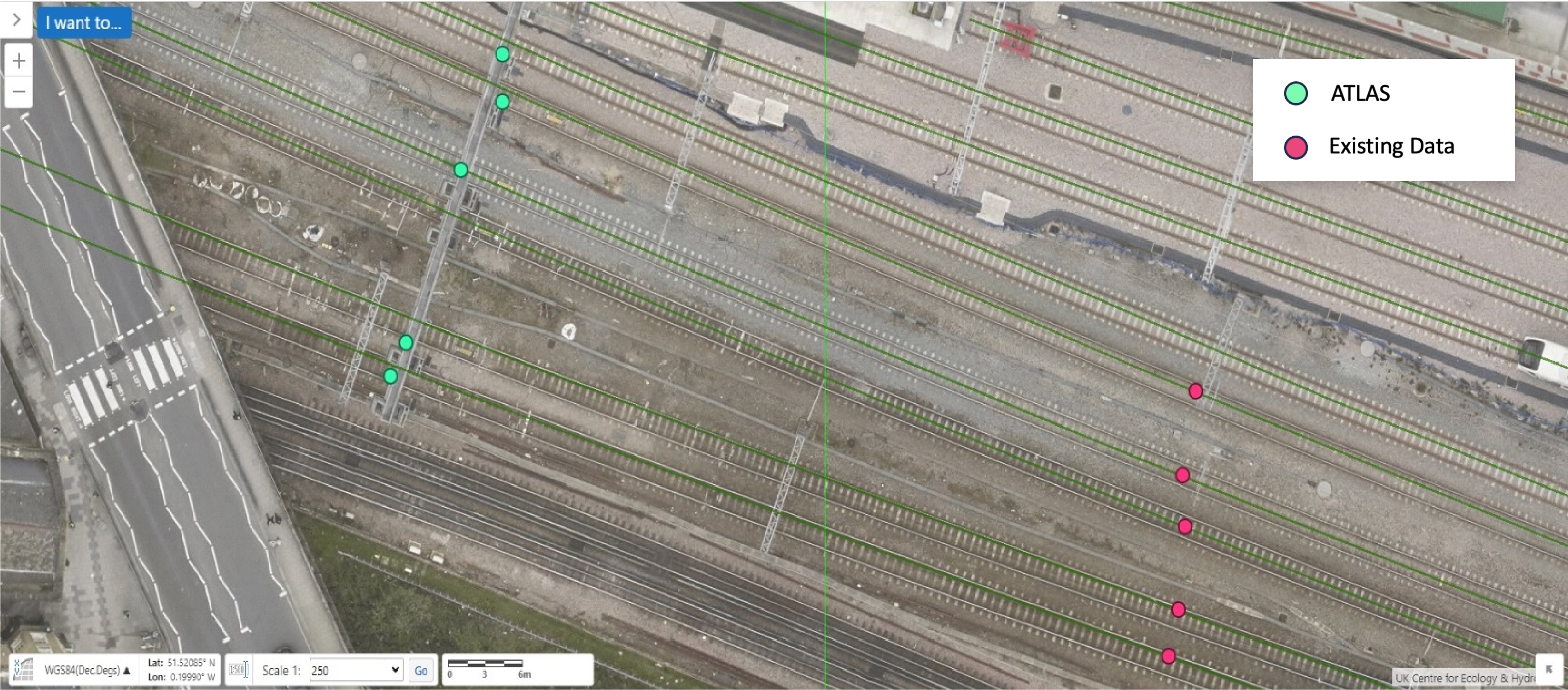
ATLAS accurately detected and positioned signals throughout the route. When reviewing the data, the position could be seen correctly placed along a gantry, compared to the latest asset data which had them a number of meters off.
In additional to signals, other asset classes detected included rails, trackbed, platforms, signage, over bridges, level crossings and vegetation.
