Accurately position a fast moving train on to the precise track, even in the absence of GPS.
Our unique ‘TrackVision’ technology can accurately position a fast moving train on the precise track from densely laid adjacent tracks, even in the absence of GPS. This provides greater consistency and more accurate information than relying on GPS and other smoothing techniques alone.
TrackVisionTM uses our advanced algorithms to review the scene, making context aware decisions when the train passes over a set of points, calculating which direction the train went.
GPS tagged video frames allow for a video’s path to be plotted on a GIS map. With GPS smoothing and track snapping, the video route can be pinned to a railway line by cross referencing the GPS location with the closest track on a known route map. However, due to GPS inaccuracies (such as through tunnels, busy cities, or simply a dense network of tracks), the chosen track may be incorrect and lead to the wrong route being plotted. This becomes a crucial issue when assigning a detected asset to a track, and trying to monitor it through repeated runs. TrackVision™ provides a solution for this problem.
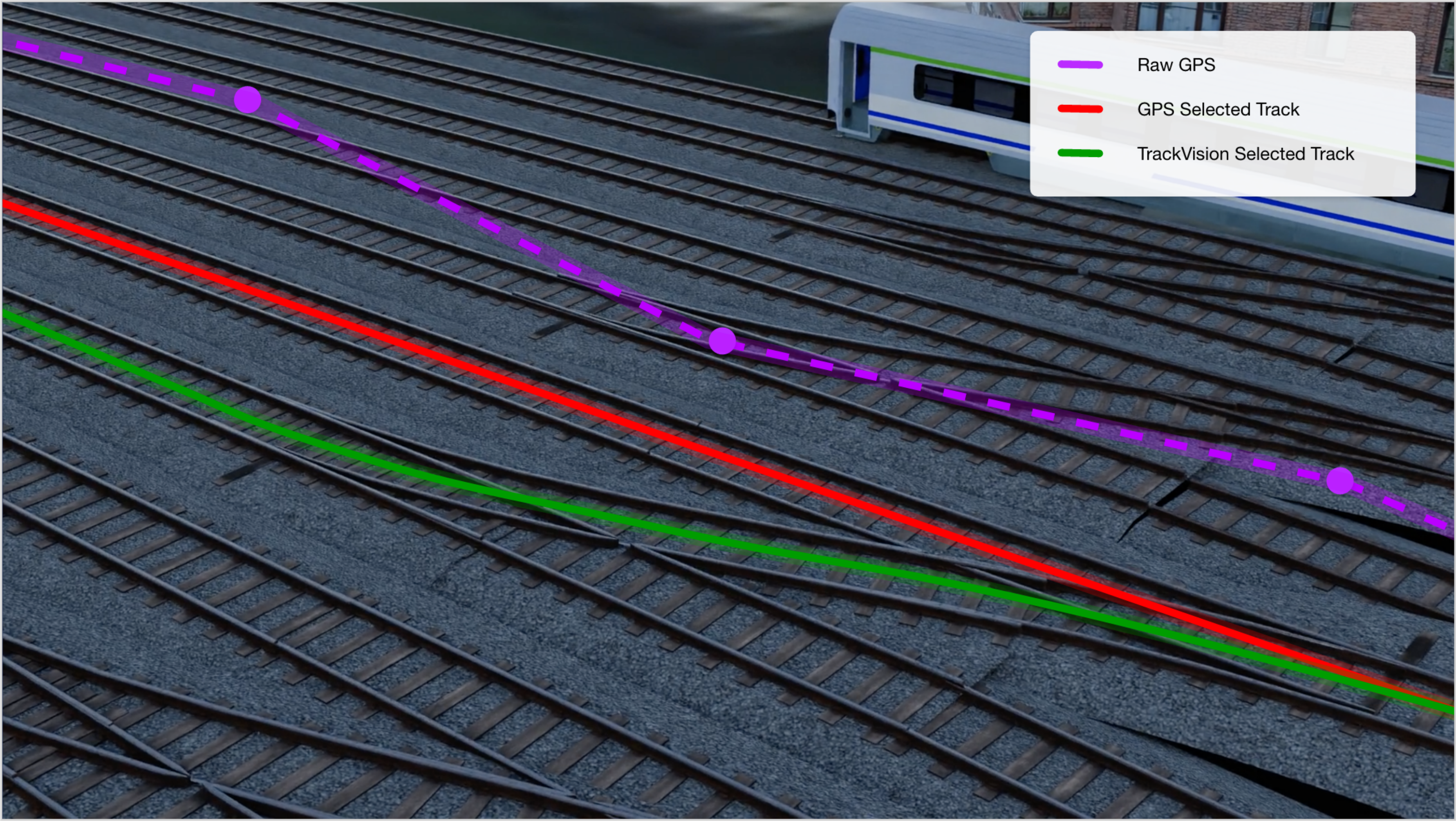
Visualisation of an incorrect track being selected using GPS alone, or the correct track being selected with TrackVision™
If you think ATLAS could fit into your workflow, we'd love to talk. Drop us a message using the button below and we'll get back to you.
Contact Us


© 2025 MobiBiz Ltd
Trading as Enable My Team