ATLAS uses an array of ML models and bespoke algorithms to extract more information from your data sets. Our AI models have been custom designed for the rail industry, across numerous data types including Video, LiDAR, Thermal and more.
ATLAS utilises a form of Machine Learning to automatically recognise asset classes. ATLAS has built up a
vast library of rail assets including line-side assets, track assets, structures and much more. Detected
assets are then geolocated with both their physical location (lat/long) and also their track position
(chainage).
Users can view the detected assets on ATLAS web based platform, to amend classifications, train new asset
classes, or delete false detections.
Additional information can then be extracted depending on the asset identified. Our built in OCR can extract readable text, such as Signal ID plates or Speed Signs, to provide additional information to the end user. This attribute data is automatically populated against the identified assets.
ATLAS can automatically convert front facing video feeds into video point clouds. Although not sub-millimeter accurate, they still provide enhanced analysis such as geo-positioning of assets or basic measurements for safe working zones.
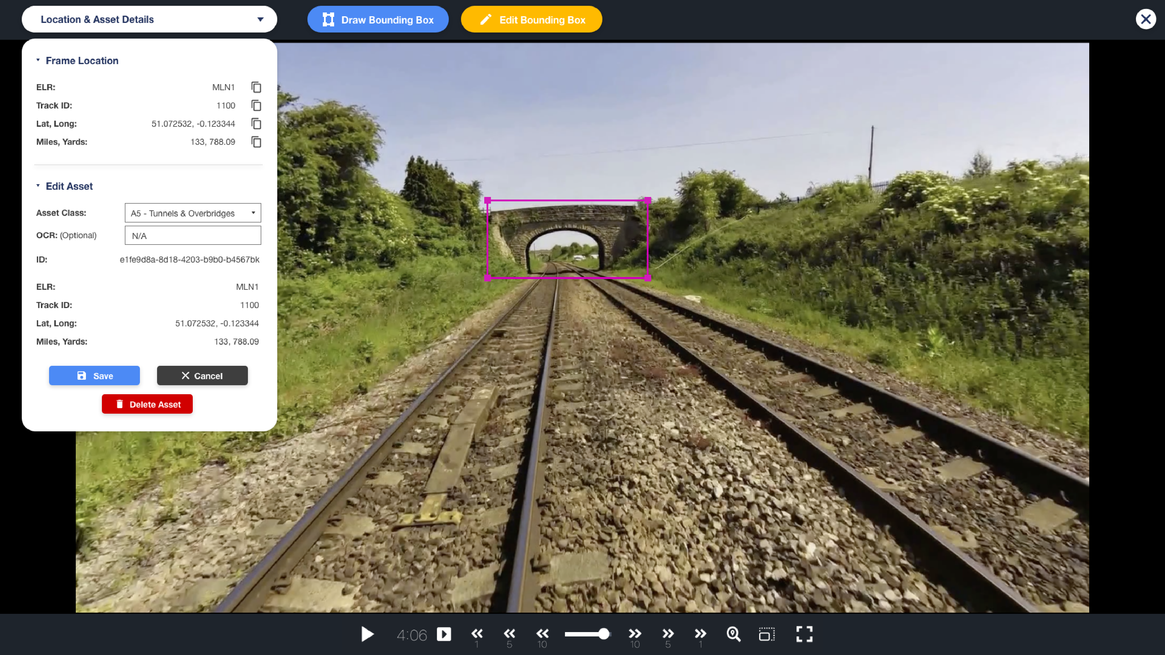
Machine Learning adjustments can be made directly in the ATLAS interface
Point clouds are generally extremely large files, and can be difficult to transfer, view and manipulate. ATLAS streams point clouds in such a way that they can be viewed on the web, with a standard browser and internet connection, without the need for sophisticated computing power. ATLAS works with all standard point cloud file types.
ATLAS has been trained on numerous asset classes and will automatically segment assets detected in a point cloud. Vegetation is also detected . Changes between clouds taken at the same location on different dates can be flagged, along with comparisons to 3D design models.
ATLAS can automatically measure clearances for both point and linear assets that it detects. These can be used for clearance profiles and gauging analysis of structures.
Vegetation is automatically segmented. Rules can be applied to alert when vegetation crosses a pre-defined threshold.
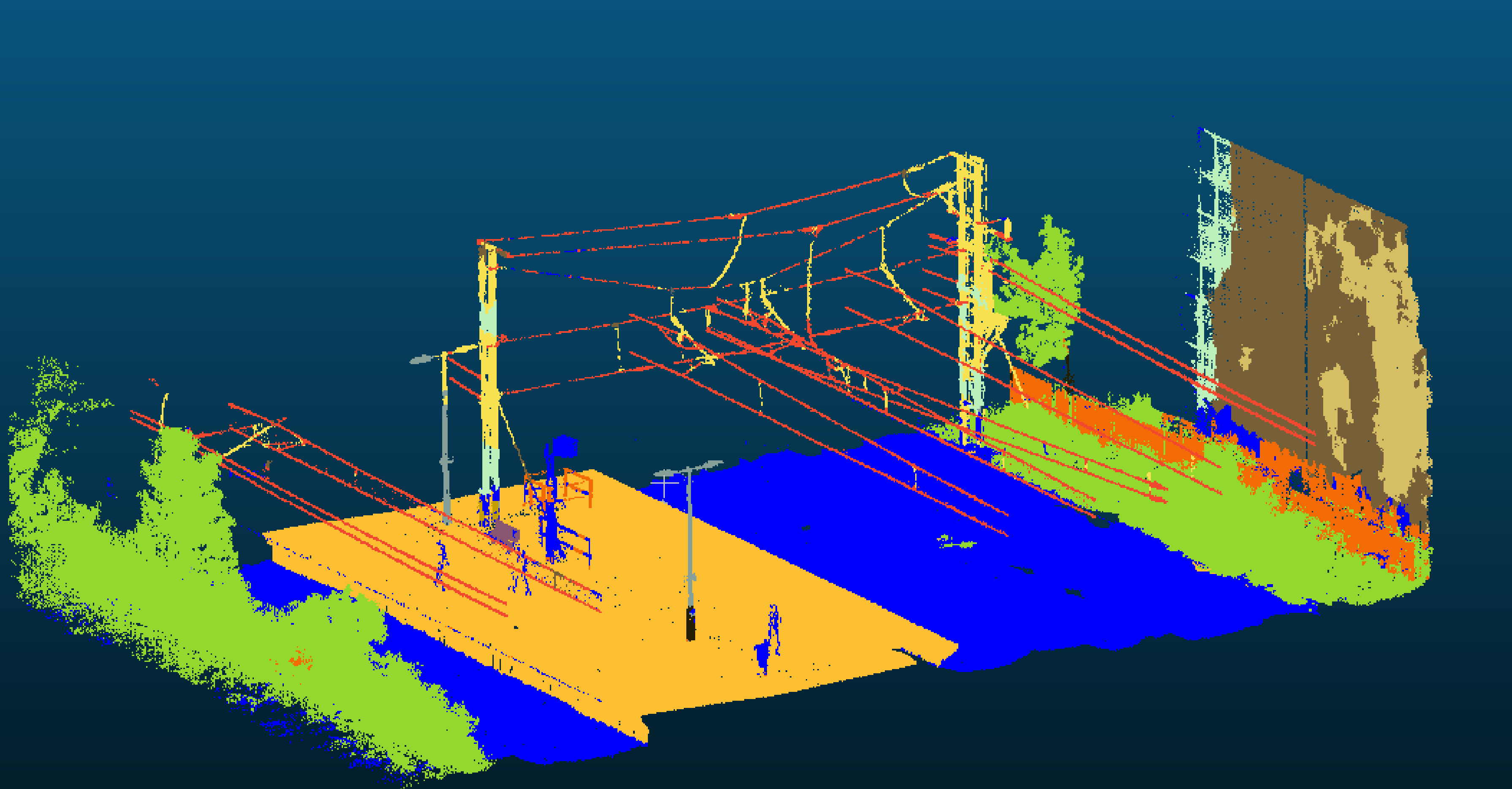
Point Clouds are automatically segmented by asset class
If you think ATLAS could fit into your workflow, we'd love to talk. Drop us a message using the button below and we'll get back to you.
Contact Us


© 2025 MobiBiz Ltd
Trading as Enable My Team